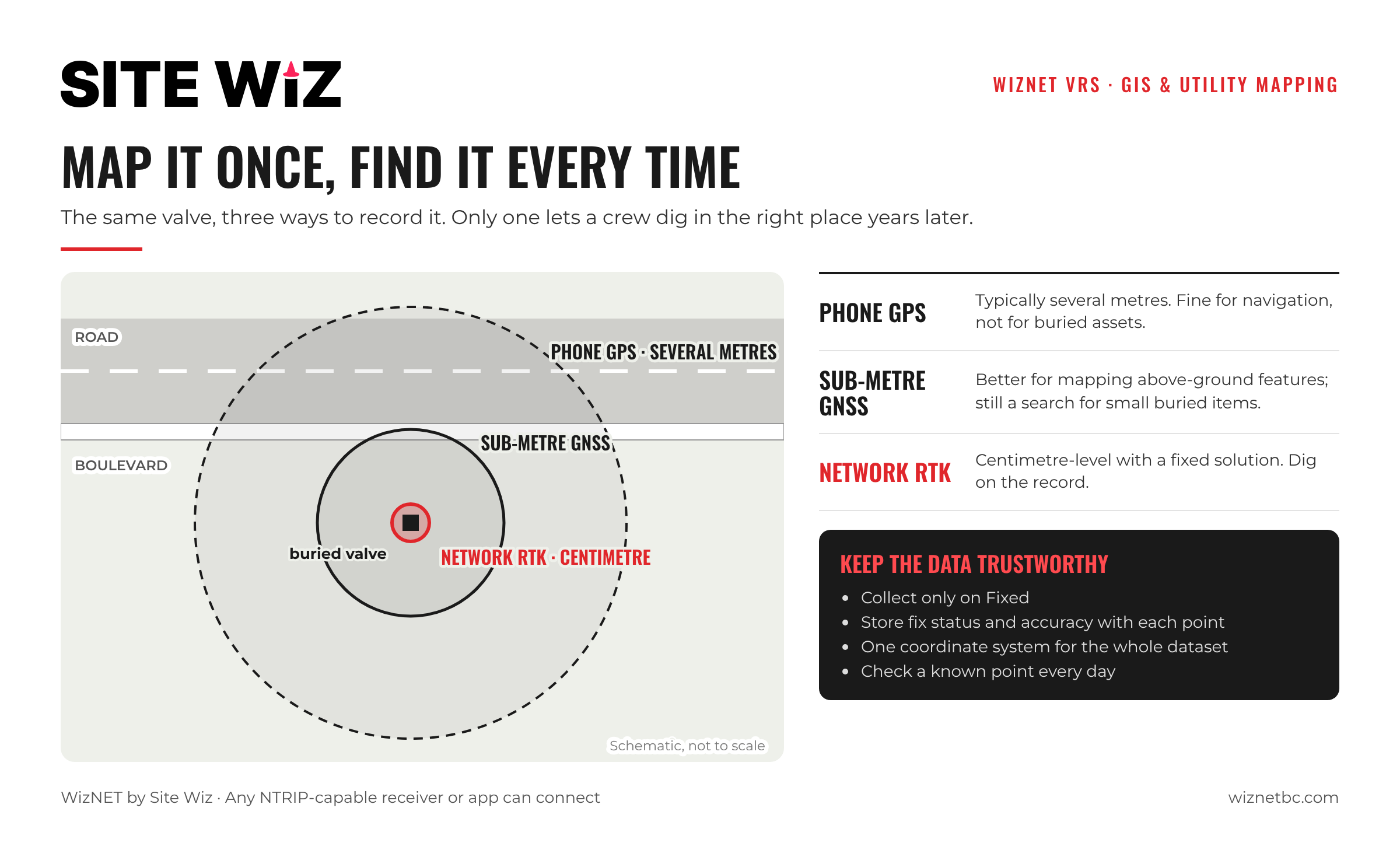
RTK is not only for surveyors. Municipal GIS teams, utilities and asset managers increasingly use RTK to map valves, hydrants, manholes, poles and service connections. The reason is simple: a record that puts a buried valve within a few centimetres is a record a crew can dig on. A record that is off by several metres is not.
This guide explains what RTK changes for GIS and utility mapping, how teams connect their data collectors to WizNET, and the checks that keep the data trustworthy.
Key Takeaways
- Phone GPS is typically good to several metres; network RTK can deliver centimetre-level positions.
- Centimetre-level asset data helps crews find buried infrastructure, plan excavations and keep records consistent over time.
- Any GNSS receiver or app that accepts NTRIP corrections can connect to WizNET.
- Record the fix status and accuracy with every point, and keep one coordinate system across the dataset.
- WizNET covers Vancouver Island, the Sunshine Coast, Sea to Sky, Greater Vancouver, the Fraser Valley, Merritt and the Okanagan.
Why Accuracy Matters for Asset Data
GIS records outlive the people who collect them. A valve mapped today will be searched for years from now, often by someone who has never been to the site, sometimes under snow, pavement or new landscaping.
- Finding buried assets: a centimetre-level location means probing in one spot instead of searching a whole boulevard.
- Planning excavations: designers and contractors can trust the map when they plan around existing services.
- Consistent records: data collected by different crews in different years lines up, because it is all tied to the same network.
What Teams Map with RTK
- Water: valves, hydrants, meters, curb stops
- Sewer and storm: manholes, catch basins, outfalls, service connections
- Roads: signs, lights, curbs, pavement markings
- Utilities: poles, pedestals, vaults, cable routes exposed during construction
- Parks and facilities: trees, trails, fixtures and boundaries of maintained areas
RTK is especially valuable during construction, when trenches are open and new services can be located before they are buried. Our guide to RTK for construction layout covers the construction side.
Connecting Your Data Collector
WizNET delivers corrections over NTRIP. Any GNSS receiver or field app that accepts NTRIP corrections can connect, using the server, port, username and password from your welcome email.
- Enter the WizNET details in your receiver or app’s NTRIP settings.
- Select a mountpoint: RTCM32-MSM (VRS) for most work, or RTCM-3X-MSM for the nearest single base. See single base vs VRS.
- Wait for a Fixed solution before collecting points.
Step-by-step guides are available for Emlid Reach and Topcon receivers.
Keeping the Data Trustworthy
- Collect only on Fixed. Set your app to reject or flag points collected in Float or Single.
- Store the quality with the point: fix status, reported accuracy and date, so future users know how much to trust it.
- Use one coordinate system. Agree the horizontal and vertical reference for the whole dataset and stick to it.
- Check a known point at the start of each day and after any long loss of fix.
- Plan for difficult spots. Trees and buildings affect GIS crews too. See our guides on RTK under forest canopy and working with weak cell signal.
Frequently Asked Questions
Do GIS teams need survey-grade receivers to use WizNET?
They need a receiver that can use RTK corrections over NTRIP. Many mapping-grade receivers and data collectors can.
How accurate is phone GPS compared with RTK?
Phone positions are typically good to several metres. With a fixed network RTK solution, positions can be centimetre-level.
Can several field crews use WizNET at the same time?
Yes. Contact the WizNET team to set up access for several field crews or data collectors.
Which plan suits a GIS team?
Teams mapping all year usually choose the annual plan; seasonal programs often choose monthly. See monthly vs annual.