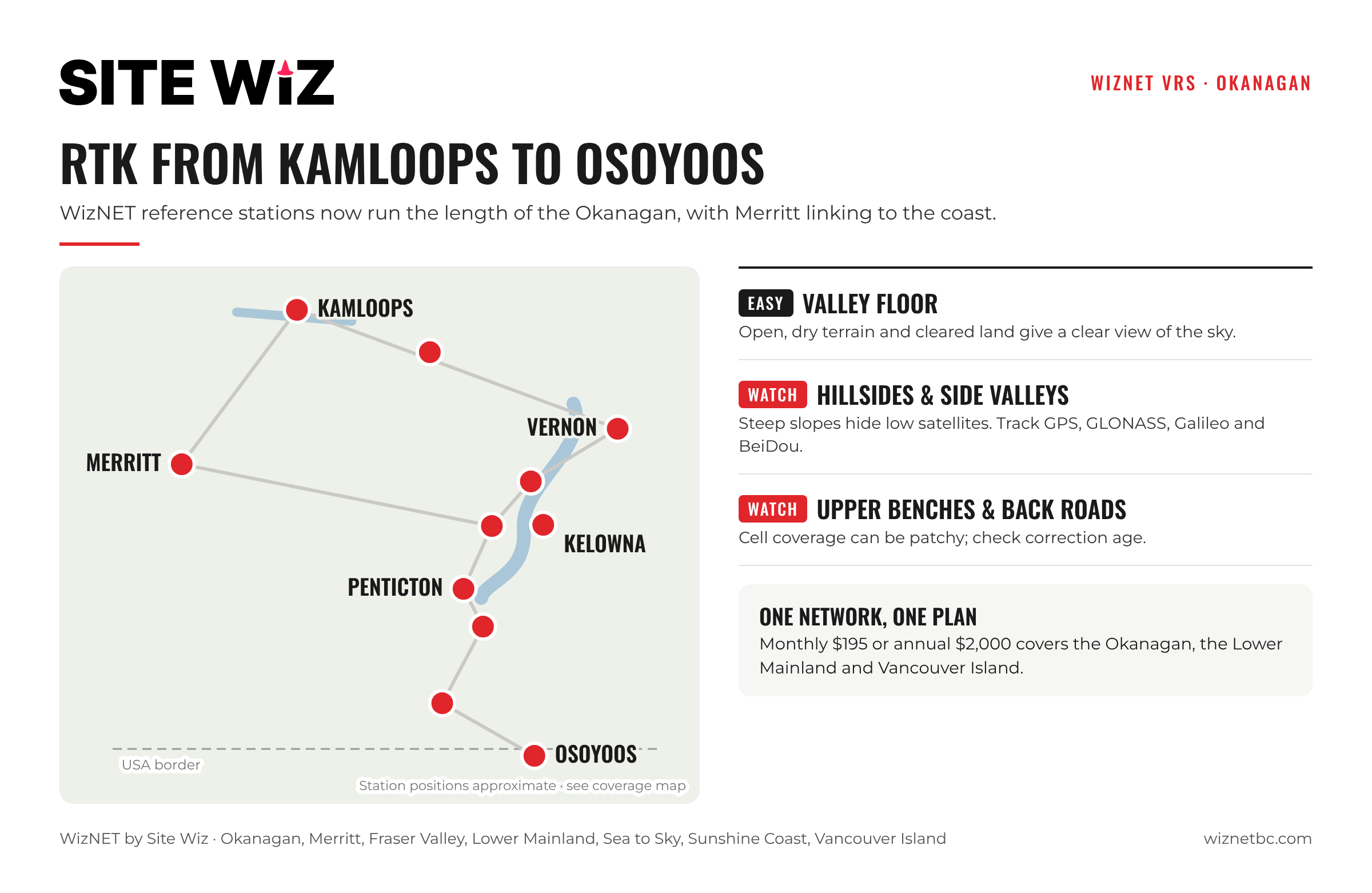
WizNET now covers the Okanagan. Reference stations run from Kamloops through Vernon, Kelowna and Penticton down to Osoyoos, with Merritt linking the Interior to the Lower Mainland side of the network. Surveyors, contractors and mapping crews working in the valley can use network RTK without setting up a base on every job.
This guide covers where WizNET works in the Okanagan, what the terrain means for your fix, and the kinds of work the network suits.
Key Takeaways
- WizNET reference stations cover the Okanagan corridor from Kamloops to Osoyoos, plus Merritt.
- Open, dry terrain in much of the valley gives receivers a good view of the sky.
- Steep valley walls and hillside sites can block low satellites; tracking all four constellations helps.
- Cell coverage is usually strongest along the valley floor and can be patchy on upper benches and back roads.
- The same monthly and annual plans cover the Okanagan and the rest of the WizNET network.
Where WizNET Works in the Okanagan
WizNET reference stations sit along the main Okanagan corridor:
- Kamloops and the area to the east
- Vernon
- The Kelowna area
- Penticton
- South of Penticton to Osoyoos, near the US border
- Merritt, connecting the Interior to the coastal part of the network
For exact station locations, see the WizNET coverage map.
Working Conditions in the Valley
Open sky on the valley floor
Much of the Okanagan is open, dry terrain with sparse tree cover, which gives receivers a clear view of the sky. Orchards, vineyards and new subdivisions on cleared land are usually straightforward places to get and hold a fix.
Valley walls and hillside sites
Steep slopes and cut banks can hide satellites low on the horizon, especially on hillside developments and narrow side valleys. Track GPS, GLONASS, Galileo and BeiDou to keep enough satellites in view. If a fix is slow, our RTK Float vs Fixed guide has a field checklist.
Cell coverage
Network RTK needs a data connection. Coverage is generally best along the valley floor and highway corridors and can be weaker on upper benches, forestry roads and the backside of hills. See our guide on working with weak cell signal.
Who Uses RTK in the Okanagan
- Surveyors on topographic, layout and as-built work for residential and commercial development.
- Civil contractors staking roads, utilities and building pads, or running machine control.
- Municipal and utility GIS teams mapping assets. See RTK for GIS and utility mapping.
- Agriculture crews laying out orchard and vineyard rows, irrigation and drainage.
- Drone operators setting ground control or feeding corrections to an RTK drone.
Getting Connected
- Choose a monthly or annual plan. The same plans cover the whole network, including the Okanagan.
- Enter the details from your welcome email in your receiver’s NTRIP settings. Guides are available for Emlid Reach and Topcon.
- Select the VRS mountpoint (RTCM32-MSM) for most work, or the nearest single base (RTCM-3X-MSM). See single base vs VRS.
- Wait for a fixed solution and check a known point before starting.
Frequently Asked Questions
Does WizNET cover Kelowna?
Yes. WizNET has reference stations in the Kelowna area, as well as Kamloops, Vernon, Penticton, Osoyoos and Merritt.
Is there a separate plan for the Okanagan?
No. The same monthly and annual plans cover the entire WizNET network.
Can I work between the Okanagan and the Lower Mainland on one subscription?
Yes. One subscription gives access to the whole network, from Vancouver Island and the Lower Mainland to the Okanagan.
Does WizNET cover the Kootenays or northern BC?
Not at present. Check the coverage map for current station locations.